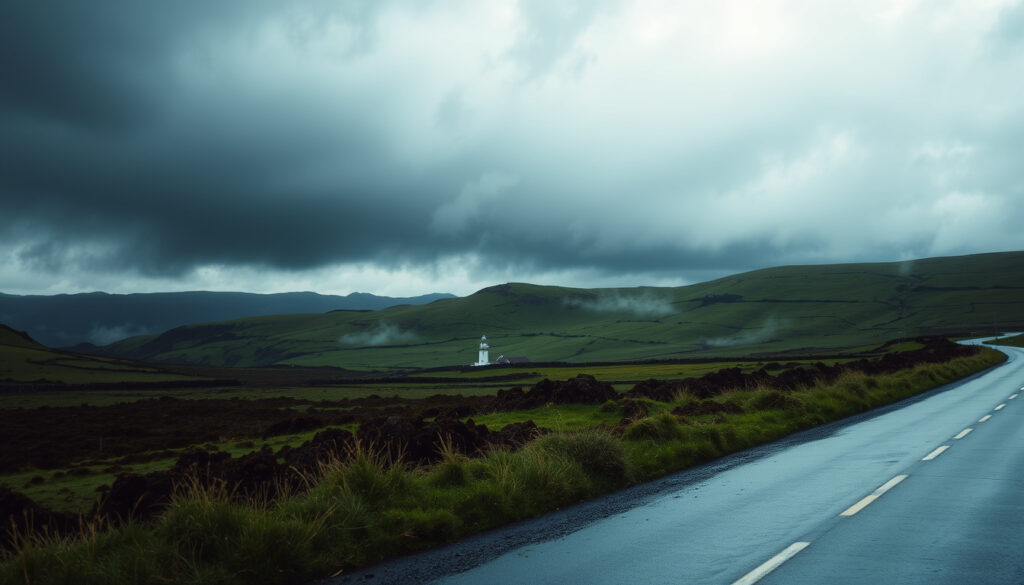
Ireland Rain Warnings: Red, Orange & Yellow Explained
Anyone who has watched an Irish forecast change three times before lunch already knows the drill: rain here comes with a colour code. Met Éireann, Ireland’s national meteorological service, stacks weather risk into three warnings — yellow, orange and red — so you know whether to plan around a shower or cancel the day (Government of Ireland, official warning guidance). This guide explains what each colour actually means, how often the island gets wet, and where to check live warnings before you head out.
Average annual rainfall: 1,000–2,000 mm depending on region ·
Rainiest city: Valentia Island, Co. Kerry, ~1,600 mm per year (Met Éireann, warning system explained) ·
Warning window: severe conditions expected within 48 hours ·
Red warnings: rare, reserved for intense meteorological events (Met Éireann, warning system explained)
Quick snapshot
- Met Éireann uses three land-warning categories: yellow, orange and red (Met Éireann).
- Orange and red warnings are less frequent than yellow; red is rare by design (Government of Ireland).
- Western counties take more rain than eastern counties in a typical year (Met Éireann).
- The yearly number of orange warnings shifts with Atlantic storm patterns.
- When the next red warning will come depends on evolving weather systems.
- Localised rainfall amounts can exceed official forecasts.
- Warnings normally cover conditions expected within a 48-hour period (Met Éireann, warning policy).
- Advisories can flag earlier risk beyond the 48-hour warning window (Met Éireann, warning policy).
- Warnings can be issued at any time of year, not just winter (Met Éireann, warning policy).
- Check Met Éireann’s live warnings page for county-by-county status (Met Éireann, live warnings page).
- Marine and small-craft warnings can be active even when no land warning is on (Met Éireann, live warnings page).
- The same warning data flows through Ireland’s official government data catalogue (Irish Government Data Catalogue).
Six numbers that explain how Irish rain warnings work, at a glance:
| Label | Value |
|---|---|
| Average annual rainfall (national) | 1,200 mm (Irish Government Data Catalogue) |
| Rainiest county | Kerry (Valentia Island) |
| Driest city | Dublin |
| Highest warning level for rain | Red |
| Common warning duration | Up to 48 hours |
| Met Éireann warning colours | Yellow, Orange, Red |
How often is it raining in Ireland?
The honest answer: a lot, but unevenly. Much of the country expects rain on roughly 150–225 days a year, and the national average rainfall sits around 1,200 mm. The interesting part is where those millimetres land.
Average number of rain days per year by region
- Ireland typically sees rain on 150–225 days per year, depending on location.
- National average rainfall is about 1,200 mm annually.
- Western counties accumulate more rain days than eastern counties.
The range exists because the island sits directly in the path of the Atlantic’s weather conveyor belt: frontal systems arrive, stall, and dump water on whatever county is underneath. Met Éireann’s station network records these totals, and the same official data underpins the national warning system.
Western counties are the reason Irish rain warnings exist — the Atlantic delivers water to Kerry and Mayo first, and the rest of the island inherits the forecast.
Seasonal variations in rainfall
- December and January are typically the wettest months.
- Summer brings drier spells, but no month in Ireland is reliably rain-free.
- The heaviest periods arrive with Atlantic low-pressure systems.
Seasonality matters for planning, but the bigger signal is geography. Rain-laden air hits the west coast first, runs into the mountains of Kerry and Mayo, and wrings out most of its water before it reaches the midlands.
Comparison of eastern vs western rainfall
- Western counties like Kerry receive more than twice as much rain as eastern Dublin in a typical year.
- Dublin’s annual rainfall is roughly 700 mm, about half of Valentia Island’s total.
- Storm warnings follow the same divide, with the west seeing more frequent alert days.
The pattern: Ireland doesn’t have one rainy season; it has a geography problem. The west catches what the Atlantic sends, the east inherits the leftovers, and the warning map follows the same divide.
What is a red weather warning in Ireland?
Red is the highest alert Met Éireann can issue, and it is meant to be rare. When it appears, the message is simple: conditions are dangerous enough that life and property may be at risk.
Criteria for a red warning for rain
- Red is reserved for rare and very dangerous weather from intense meteorological phenomena.
- For rain, a red warning typically comes when totals reach roughly 50–70 mm in 24 hours or when flooding is imminent.
- At red level, the impact — not just the rainfall count — is the deciding factor.
The word officials keep using is “rare”. Red warnings are intended to be the exception, and they are triggered only when forecasters have enough confidence to tell the country to shut things down (Government of Ireland, official safety guidance).
Examples of past extreme rainfall
- The highest recorded 24-hour rainfall in Ireland is 243 mm at the Gap of Dunloe, Co. Kerry, recorded in 1986.
- Red warnings can be issued at much lower totals when the ground is already saturated.
- The focus is on what the rain will do, not just how many millimetres fall.
The 1986 Gap of Dunloe record shows what extreme physically looks like in Ireland. But a red alert is not about breaking records; it is about rivers already at their limits, drainage overwhelmed, and communities that cannot move water fast enough.
Safety actions during a red warning
- Red warnings advise people to take action to protect themselves and their property and to follow official instructions.
- Schools, businesses and public services are expected to close where the warning covers their area.
- Travel is discouraged, because emergency services will be stretched.
The trade-off: red warnings arrive late by design, only when forecasters are confident enough to stop normal life. That confidence costs time — and time is exactly what an Atlantic storm does not give.
Which is stronger, yellow or orange warning?
On the Met Éireann scale there are exactly three land-warning colours, and they stack in a strict order: yellow, orange, red. Orange is not a slightly annoyed yellow; it is a different risk category. Met Éireann defines orange as infrequent and dangerous weather that may threaten life and property (Met Éireann, Ireland’s national weather service).
Differences in severity between yellow, orange, and red
- Yellow: weather that is not generally threatening to the population but may be dangerous locally.
- Orange: infrequent and dangerous weather that may threaten life and property.
- Red: rare and very dangerous weather from intense meteorological phenomena.
Three colours, three instructions — here is how the official definitions, the typical rainfall scale and the advised response line up:
| Warning colour | What it means | Typical rainfall scale | Official advice |
|---|---|---|---|
| Yellow | Not generally threatening, but may be dangerous locally | Localised disruption possible | Be aware; avoid unnecessary risks |
| Orange | Infrequent and dangerous weather that may threaten life and property | 40–60 mm forecast in 12 hours | Prepare; reconsider activities and events |
| Red | Rare and very dangerous weather from intense phenomena | 50–70 mm in 24 hours or imminent flooding | Take action; protect yourself and property |
Orange is the level where plans get cancelled — it is the warning that tells a county to prepare for significant damage, while yellow still allows everyday life to continue.
Typical impact of each warning level
- Yellow: localised flooding, slower traffic, a day that is more annoying than dangerous.
- Orange: significant disruption — travel problems, event cancellations and possible damage.
- Red: danger to life and property; public services wind down and people are told to stay put.
The implication: yellow is a heads-up, orange is the decision point, red is the instruction. Most practical weather disruption in Ireland starts at orange, because that is the level where officials expect things to break.
How to prepare for an orange warning
- Check whether your county is inside the warning zone before making plans.
- Clear gutters and drains around your property if heavy rain is forecast.
- Have a plan for journeys, because orange-level rain can close roads quickly.
Orange warnings are the threshold where officials expect significant disruption, making them the critical decision point for travel and events.
What city in Ireland gets the most rain?
If you are comparing Dublin, Cork, Limerick and Galway for a move or a holiday, the short answer is: go west for the scenery and the rain, go east for the drier days.
Comparison of annual rainfall in major cities
- Valentia Island, Co. Kerry: ~1,600 mm per year — Ireland’s wettest weather station.
- Cork: roughly 1,200 mm per year.
- Dublin: around 700 mm per year — the driest of the main cities.
These gaps are not marginal. West Kerry takes in more than double Dublin’s rainfall in a normal year, and the difference shows up in warning statistics too: western counties collect noticeably more rainfall alerts than the east.
Factors influencing rainfall distribution
- Atlantic frontal systems hit the west coast first.
- Mountains in Kerry, Mayo and Donegal force air upward, cool it and wring out extra rain.
- The east sits in a rain shadow created by Ireland’s own high ground.
The result is a pattern where the wettest places are also the steepest and most exposed. That combination does not just produce more rain; it produces more flooding risk when warnings are issued.
Why western cities are wetter
- Valentia’s exposed Atlantic position means rain arrives with almost every low-pressure system.
- Saturated catchments make the west more prone to flood alerts during heavy rain events.
- Dublin’s sheltered east-coast location yields fewer rain days and lower totals.
What this means: “rainiest city” is not a trivia answer. It predicts where warnings concentrate. When Met Éireann colours a county map orange or red, Kerry and the west are statistically the first places to be shaded.
What are the current rain warnings in Ireland today?
Rain warnings change quickly, so any fixed list goes stale within hours. What you need instead is the right place to look, and an understanding of what the maps are actually telling you.
How to check live Met Éireann warnings
- The Met Éireann website publishes all land, marine and small-craft warnings on its live warnings page (Met Éireann, live warnings page).
- The Irish Weather App pushes the same warnings to your phone.
- When the page was last indexed, no land warnings were active, while yellow small-craft warnings covered sections of the Irish Sea and south coast waters.
The absence of a land warning does not mean the coast is calm. Marine warnings can remain in place for waters and small craft even when no land warning is operating — a reminder that the sea and the shore do not always share the same forecast.
Interpreting warning status on official maps
- Warnings are shown on a county-by-county colour map.
- The same data is published as an open dataset through Ireland’s official government data catalogue (Irish Government Data Catalogue, county weather-warning dataset).
- Yellow icons mean “be aware”; orange and red carry explicit impact warnings.
The county-level view matters because an Atlantic storm rarely covers the whole island. One county can be under an orange warning while its neighbour stays yellow, and the map is the fastest way to see which side of the line you are on.
Regional breakdown of active warnings
- Land warnings apply to specific counties rather than the whole country.
- Marine and small-craft warnings can be active when no land warning is in operation.
- The official warnings page is the source Irish news outlets rely on when they report “status orange” or “status red”.
A calm morning can still carry a marine warning — the sea does not wait for land warnings to be lifted, and coastal counties can change status within a single forecast update.
The habit: check the warnings page the way you check the time. A warning that is not on the map yet can be on your road before lunch.
What’s confirmed and what’s still unclear
Confirmed facts
- Met Éireann issues colour-coded warnings for rain using yellow, orange and red (Met Éireann).
- Orange and red warnings are less frequent than yellow; red is rare by design (Government of Ireland).
- Western areas of Ireland receive more rain than eastern areas (Met Éireann).
- Rainfall and warning data are collected and published by official Irish meteorological sources (Irish Government Data Catalogue).
What’s unclear
- The exact number of orange warnings each year shifts with Atlantic storm patterns.
- When the next red warning will be issued depends on evolving weather systems.
- Localised rainfall amounts can exceed official forecasts.
- Whether a land warning is active at any given moment can change within hours.
What the authorities say about rain warnings
“Orange means infrequent and dangerous weather that may threaten life and property.”
Met Éireann, Ireland’s national weather service — warning system explained
“Red warnings advise people to take action to protect themselves and their property and follow official instructions.”
Government of Ireland — official weather-warning guidance
Ireland’s rain warnings exist because the Atlantic makes the country a testing ground for weather: yellow tells you to be aware, orange tells you to prepare, red tells you to act. The colours are only useful if you check them before a journey and treat the official county map — not the view from your window — as the source of truth. For anyone living in western or coastal counties, the habit is clear: check Met Éireann’s warnings page the way you check the time, because the storm that closes a mountain road rarely sends an invitation first; the alternative is discovering the warning while the water is already on the road.
Related reading
- Cork 10 Day Forecast: Weather Outlook & Climate Guide — a closer look at one of the rainiest urban areas in Ireland.
- Older Drivers Car Tax Changes 2026: UK & Ireland Guide — practical Ireland-focused guidance for planning around policy changes.
met.ie, met.ie, citizensinformation.ie, assets.gov.ie, met.ie
Frequently asked questions
What does a yellow weather warning mean in Ireland?
A yellow warning means weather that is not generally threatening to the population but may be dangerous locally. Met Éireann advises people to be aware of the conditions and avoid unnecessary risks. It is the lowest of the three land-warning levels.
How long does a red weather warning last in Ireland?
Met Éireann warnings normally concern severe or extreme conditions expected within a 48-hour period. A red warning stays active while those extreme conditions persist and is lifted once the threat passes or downgrades.
Can I travel during an orange rain warning?
Orange means infrequent and dangerous weather that may threaten life and property. Official guidance says people in affected areas should prepare appropriately and reconsider activities or events. If you travel, expect disruption and check the county-by-county warning map first.
Where does Met Éireann publish official warnings?
Met Éireann publishes warnings on its website and through the Irish Weather App. The county-by-county warning status is also available as an open dataset through Ireland’s official government data catalogue.
What is the difference between a rain warning and a snow warning?
Both use the same yellow-orange-red scale and the same 48-hour forecast window. The difference is the hazard: rain warnings focus on rainfall totals, flooding and saturated ground, while snow warnings focus on accumulation, ice and travel disruption.
How can I get weather warnings on my phone in Ireland?
Install the Irish Weather App from Met Éireann, which mirrors the official warnings page including land and marine warnings. The app and the met.ie website are the authoritative sources.
Are there any apps that show Ireland rain warnings?
The Irish Weather App shows official Met Éireann warnings. International forecasters such as BBC Weather, AccuWeather and the Met Office also cover Ireland, but for official county-by-county status, the Met Éireann app and website are the reference points.
What should I do if a red warning is issued while I’m driving?
Red warnings advise people to take action to protect themselves and their property and follow official instructions. If a red weather warning is issued for rain while you are driving, the safest step is to find a safe place to stop and wait for conditions to ease, because flooding can close roads quickly.
More related posts
 Easter School Holidays 2026: Dates for Ireland & Northern Ireland
 What’s on in Dublin This Weekend? Curated Events for Everyone
 Is Bread Soda the Same as Bicarbonate of Soda
 Truth Social Donald Trump: Latest Posts & App Guide
 Galway United vs Derry City FC – Match Preview and Prediction
 What Is a CRC Error? Causes, Fixes, and Prevention
 How to Bake Potatoes in Oven for Crispy Skin
 Houses for Sale in Cork: 3-Bed, Detached & Buying Guide
