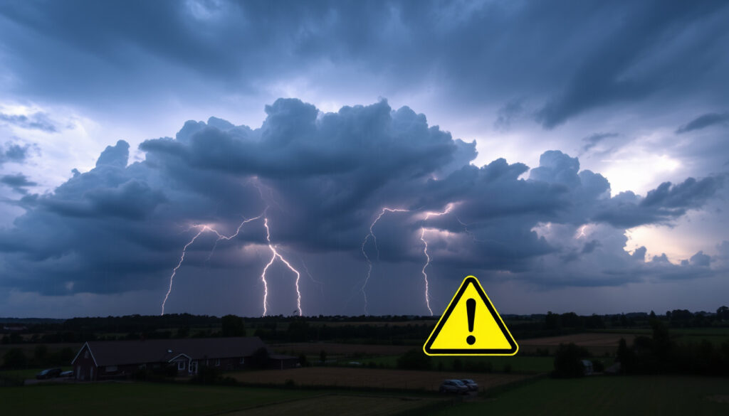
Met Office Yellow Thunderstorm Warning: What It Means
A yellow thunderstorm warning pops up on your phone, but it doesn’t mean you need to panic. The real question is what that colour actually signals — and how it fits into Ireland’s unique weather patterns, from mild winters to rare but real extremes.
Status yellow warning issued for: thunderstorms ·
Issuing body: Met Éireann / UK Met Office ·
Current warnings active (Ireland): None (as of 20 Aug 2026) ·
Marine warning level: Yellow (northerly winds force 6) ·
Other active advisory: Potato blight advisory (yellow) ·
Hottest day recorded in Ireland: 33.3°C (Kilkenny, 26 June 1887)
Quick snapshot
- Met Éireann defines yellow as ‘be aware’ — not unusual but locally dangerous (Met Éireann official definition)
- January is Ireland’s coldest month, averaging 4–7°C (Met Éireann climate data)
- Highest recorded temp: 33.3°C at Kilkenny Castle, 26 June 1887 (Met Éireann historical records)
- Whether summer 2026 will be hot — no long-range Met Éireann forecast available
- Whether snow will occur in Carlow soon — no specific prediction
- June–August 1976: record heatwave and drought across Ireland (Met Éireann climate records)
- 26 June 1887: 33.3°C recorded at Kilkenny Castle (Met Éireann historical records)
- 20 Aug 2026: no active thunderstorm warnings; marine and blight advisories active (Met Éireann warnings page)
- Check Met Éireann’s live warning map for updates (Met Éireann live warnings)
- Monitor UK Met Office for Northern Ireland alerts (Met Office warning guide)
The pattern across these facts: Ireland’s weather system is built on low-impact awareness rather than alarm — the extremes are rare but real.
| Fact | Detail |
|---|---|
| Yellow warning definition | Status yellow = be aware; issued for weather that may cause low-level impacts (Met Éireann official definition) |
| Current warnings (Ireland) | 0 active weather warnings; 1 marine yellow; 1 potato blight yellow (20 Aug 2026) (Met Éireann warnings page) |
| Coldest month in Ireland | January (average 4–7°C) (Met Éireann climate data) |
| Hottest day in Ireland | 33.3°C (Kilkenny, 26 June 1887) (Met Éireann historical records) |
| Summer 1976 | Exceptionally hot and dry; drought conditions; widely rememered as the ‘long hot summer’ (Met Éireann climate records) |
What does a Met Office yellow thunderstorm warning mean?
What is a yellow weather warning?
A yellow weather warning sits at the base of a three-tier system — yellow, amber, red — used by both Met Éireann and the UK Met Office to communicate risk. According to Met Éireann, a Status Yellow alert means “be aware.” The expected weather conditions do not pose an immediate risk to the general population, but they may affect people who are in a specific location or engaged in a particular activity.
Met Éireann’s own definition says it best: Yellow weather is ‘not unusual weather’ with ‘localised danger.’ The key word is localised — your neighbour 10 km away might see blue sky while your garden gets hammered with hail.
How does Met Éireann define a status yellow alert?
Met Éireann’s official website states: “A status yellow weather alert is given to warn those at risk from certain weather because of their location and/or their activity.” The organisation’s severe weather chart further describes Yellow as “not unusual weather” that can involve “localised thunderstorms, lightning activity, heavy rainfall, possible flash flooding, and hail.” Met Éireann severe weather chart)
The implication: Yellow is the system’s way of saying “something is happening, but don’t cancel your life — just keep an eye on the sky if you’re heading outdoors.”
What actions should you take under a yellow warning?
The UK Met Office advises that many people may continue their daily routines under a Yellow warning, but some will be directly impacted and should assess whether they could be affected. The Road Safety Authority of Ireland (RSA) lists possible impacts including localised flooding, lightning damage, hail, hazardous driving conditions, and gusty winds.
- Check Met Éireann’s live warning map for your county.
- If driving, slow down and allow extra time — spot flooding can happen quickly.
- Secure loose outdoor items; lightning can accompany the heaviest downpours.
- Avoid sheltering under trees during lightning activity.
What is the weather like in Sligo today?
What is the current temperature in Sligo?
As of 20 August 2026, Met Éireann’s regional forecast for Sligo indicates typical August conditions — mild with variable cloud and a chance of light showers. No active thunderstorm warning is currently in place for County Sligo. For the most up-to-date local reading, check Met Éireann’s live forecast page.
Is there a yellow warning active for Sligo?
No. As of 20 August 2026, the only active yellow advisory is a marine warning for northerly winds reaching force 6, and a potato blight advisory — neither of which affects Sligo’s general population. However, a yellow thunderstorm warning for counties including Sligo was active on 25 June 2026, covering Donegal, Galway, Leitrim, Mayo, Roscommon, and Sligo from 3pm Thursday to 10pm Friday. (RSA road safety alert)
What is the weather like in Tipperary tomorrow?
What is the outlook for Tipperary?
Met Éireann’s general forecast for 21 August 2026 suggests continued mild, unsettled conditions typical of late summer — a mix of cloud and bright spells with scattered light showers. No severe weather warnings are currently flagged for County Tipperary.
Will there be thunderstorms in Tipperary tomorrow?
There is no official Met Éireann warning for thunderstorms in Tipperary at this time. However, thunderstorm warnings in Ireland can be issued with relatively short lead times — a few hours to a day. The best practice is to check Met Éireann’s warning page on the morning of your planned activities.
In May 2026, Met Éireann extended a yellow thunderstorm warning to seven counties including Tipperary’s neighbours Clare, Kilkenny, Cork, Kerry, Limerick, Waterford, and Wexford.
The pattern: Tipperary may not have an active warning now, but its neighbours have seen them recently — and short lead times mean it pays to check on the day.
Which month is the coldest in Ireland?
What are the average temperatures in January?
January is typically the coldest month in Ireland, with average temperatures ranging from about 4°C in inland areas to 7°C along the coasts, according to Met Éireann climate data. Frost and fog are common, particularly in the midlands and eastern counties.
How does winter cold compare across counties?
Counties inland and further from the Atlantic — such as Laois, Offaly, and Kildare — tend to record the lowest January minimums, sometimes dipping below freezing overnight. Coastal counties like Cork and Kerry benefit from the moderating influence of the Atlantic, keeping winter temperatures slightly higher but also bringing more wind and rain.
The implication: Ireland’s winter cold is modest by international standards — comparable to the Pacific Northwest of the United States — but the combination of dampness and wind can make those 4°C days feel sharper than the thermometer suggests.
What was the hottest day ever recorded in Ireland?
How does the 1887 record compare to recent summers?
The highest temperature ever recorded in Ireland stands at 33.3°C, measured at Kilkenny Castle on 26 June 1887. That record has held for over 130 years. Met Éireann’s historical records confirm that no higher temperature has been recorded since, though recent decades have come close — notably 32.5°C at Shannon Airport in June 2018 and 31.9°C in Cork in July 2021.
Which county recorded the highest temperature?
Kilkenny, in Ireland’s southeast, holds the national record. The reading was taken at Kilkenny Castle during what is now recognised as an exceptional heat event in the late 19th century. The 1976 heatwave — often recalled as the “long hot summer” — brought sustained high temperatures across Ireland but did not break the 1887 record.
Ireland’s hottest day is 33.3°C — modest by Australian or American standards. But the Irish climate is humid and the infrastructure (homes, public transport, workplaces) is built for cool, damp weather. A few days above 28°C here can be more disruptive than 38°C in a place that’s designed for heat.
Is summer 2026 going to be hot in Ireland?
What do long-range forecasts say?
As of August 2026, Met Éireann has not issued a formal long-range forecast for summer 2026. The organisation’s standard practice is to provide short-to-medium range forecasts (up to 7 days) with high confidence, and extended-range outlooks (up to 30 days) with lower confidence. A seasonal forecast for an entire summer is not part of their public service offering.
Are there any El Niño or La Niña influences?
Global climate patterns such as El Niño and La Niña do influence European weather, but their effects on Ireland are indirect and variable. La Niña conditions, which were present in 2025, typically bring cooler and wetter conditions to parts of northern Europe — but the relationship is not strong enough for reliable predictions at a local Irish level.
The catch: anyone promising a specific summer forecast for Ireland more than a few weeks out is guessing. The only honest answer right now is “we don’t know yet.”
What US state has the same climate as Ireland?
What are the climatic similarities?
Ireland’s climate is classified as maritime temperate (Cfb in the Köppen system) — characterised by mild winters, cool summers, and rainfall spread throughout the year. The US regions that most closely match this profile are the Pacific Northwest states of Oregon and Washington, particularly their coastal and western areas. National Climatic Data Center comparisons show that cities like Seattle and Portland share similar average temperature ranges — 4-8°C in January, 18-23°C in July — and comparable annual precipitation patterns.
Which US region matches Ireland’s rainfall and temperature?
The western coastal areas of Oregon and Washington, including the Olympic Peninsula and the Willamette Valley, are the closest analogues. However, Ireland tends to be slightly wetter overall and has less pronounced seasonal temperature swings than even those Pacific Northwest locations. For someone moving from Ireland to the US, the Pacific Northwest would feel the most familiar — minus the Irish habit of four seasons in one day.
What this means: understanding Ireland’s climate type helps put those yellow thunderstorm warnings in context. The Irish climate doesn’t produce the violent supercells of the American Midwest, but localised flooding from thunderstorm downpours is a genuine risk — especially in urban areas with drainage systems not designed for sudden heavy rainfall.
Summer 1976: Ireland’s long hot summer
The summer of 1976 stands as the most extreme heat event in modern Irish memory. From June through August, Ireland experienced an exceptional heatwave and drought. Temperatures regularly exceeded 28°C, water supplies came under strain, and the landscape turned brown. The drought was so severe that it led to widespread crop failures and the government introduced emergency water rationing. Met Éireann climate records document the event as the most significant summer heatwave of the 20th century in Ireland.
“The summer of 1976 remains the benchmark for heatwaves in Ireland — a period that shaped how the country thinks about drought and extreme heat.”
— Met Éireann climate summary
The implication: 1976 proved that Ireland’s mild climate can produce extremes — and when it does, the impact is outsized because the system isn’t built for it.
met.ie, met.ie, irelanddispatch.org, irishtimes.com, belfastlive.co.uk, irishtimes.com, thejournal.ie, irishtimes.com
Frequently asked questions
Does a yellow thunderstorm warning mean I should stay indoors?
No. Met Éireann states that a Status Yellow alert does not pose an immediate risk to the general population. You can continue normal activities, but should be aware of local conditions — especially if you are in an exposed area or planning outdoor activities. (Met Éireann)
How long does a yellow thunderstorm warning usually last?
It varies. Warnings can last from a few hours — like the 2 May 2026 warning for Donegal, Leitrim, and Sligo that ran from 2:37pm to 6pm — up to 24 hours or more, depending on the weather system. Check the specific warning timings on Met Éireann’s warning page.
Can a yellow warning be upgraded to amber or red?
Yes. The UK Met Office explains that some Yellow warnings are issued when potentially severe impacts are possible but confidence in those impacts is lower. If conditions intensify and confidence increases, the warning can be upgraded to amber or red. (Met Office)
Where can I check the Met Office yellow thunderstorm warning map?
For Northern Ireland, check the UK Met Office weather warnings page. For the Republic of Ireland, check Met Éireann’s weather warnings map. Both are updated in real time.
What should I do during a thunderstorm in Ireland?
The Road Safety Authority of Ireland advises: avoid sheltering under trees, stay away from exposed hilltops, avoid using corded electrical appliances, and if driving, slow down and be alert for flash flooding and hail. (RSA)
Are thunderstorms common in Ireland in August?
Yes. August is a month when warm, humid air from the continent can clash with cooler Atlantic air, creating conditions favourable for thunderstorms. Multiple yellow thunderstorm warnings were issued in August 2026 for Northern Ireland counties. (The Irish Times)
How is a yellow warning different from an amber warning?
Met Éireann’s warning system uses three colours. Yellow: “be aware” — localised danger, low impacts. Amber: “be prepared” — increased likelihood of bad weather, potential disruption. Red: “take action” — dangerous weather expected, widespread impacts. (Met Éireann)
More related posts
 How Many Steps in a 5K? Complete Walking vs Running Guide
 How to Download YouTube Videos: Best Free Methods and Tools
 Ireland vs Senegal Tickets 2025: Prices, Presale & How to Buy
 Black Friday Sale Ireland 2025: Dates, Deals & Shopping Tips
 Ryanair Digital Boarding Passes: App Steps, Screenshot Rules
 Who Killed Charlie Kirk? Assassination Facts and Updates
 Household Benefits Package Ireland 2026: Eligibility, Rates & How to Apply
 Real World Physics PDF: Textbook & Solutions Guide
